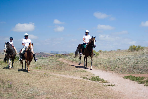
Bellvue, Colorado
Closest city: Denver, Colorado.
Travel distance: 74 miles.
Driving directions: Take Interstate 25 north toward Fort Collins. Take Exit 269B to merge onto Colorado State Highway 14/East Mulberry St. toward Fort Collins. Take a slight right onto Riverside Ave. Continue onto Jefferson St. Turn right onto CO-14 west/U.S. Highway 287 north/North College Ave. Continue onto U.S. 287. Take a slight left onto Rist Canyon Rd. Turn left onto North County Rd. 23/North County Rd 23E. Turn right onto North County Rd. 25G. Turn left onto Lory Park Rd. Turn right onto Lodgepole Dr.
Terrain: Primitive Precambrian rock formations underlay the park’s trails, and are exposed over the park’s western two-thirds. Trails provide access to scenic overlooks, bays, and coves. Aspen, Ponderosa pine, Douglas fir, and Rocky Mountain Juniper trees are abundant. The area is renowned for its nearly 200 resident bird species, including the lark bunting, horned lark, western meadowlark, raptors, and waterfowl/shorebirds.
History: Humans first occupied the land during the Paleolithic period. In the 1700s and 1800s, Native Americans used the area for hunting and camping. Early settlers came to the area to mine, but many of those who stayed turned to farming and ranching. On May 7, 1975, the park was named Lory State Park in honor of Dr. Charles A. Lory, an early settler in the area and president of Colorado Agricultural College at Colorado State University from 1909 to 1940.
Top ride: Timber Trail is a 4.2-mile moderate-to-difficult ride that climbs through lush grassy meadows and mountain shrub land, ascending to pine and fir as the elevation rises. The 12 percent grade leads to a variety of primitive backcountry sites with some switchbacks and rocky scrambles. Scenic rolling and mountainous hillsides accompany you throughout the day. Look for wild turkeys in the gullies, and dusky grouse along the trail and perched in the trees, along with access to many scenic overlooks, bays, and coves.
Amenities: Picnic sites.
Map: Download a trail map at http://tinyurl.com/n4cfdst.
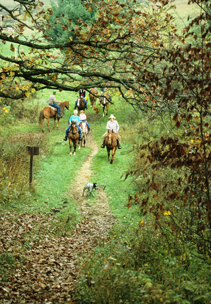
Wildcat Mountain State Park, Ontario, Wisconsin
Closest city: Madison, Wisconsin.
Travel distance: 92 miles.
Driving directions: From U.S. Highway 14 in Readstown, take State Highway 131 north about 23 miles to County Highway F. Go right (east) on Highway F about 1.5 miles to State Highway 33. Turn left (west) on Highway 33, and go about .6 miles to the park entrance, which will be on your right.
Terrain: The 3,643-acre Wildcat Mountain State Park is located on a steep ridge overlooking the Kickapoo River Valley. The Kickapoo River meanders through the park, and is surrounded by the large pine and hemlock trees native to northern Wisconsin.
History: The area now encompassing Wildcat Mountain State Park was missed by the glaciers
that covered most of the state during the Ice Age. The area is a sample of what Wisconsin must’ve looked like more than 10,000 years ago. The hills, made of Precambrian sandstone with limestone tops, have many exposed bluffs. The area was once a favored route of migrating Native American hunting parties, as far back as 2,000 BC. In the 1800s, European immigrants from the Eastern United States settled the valley to harvest timber. In 1947, the legislature voted to create a state park in the area. In 1948, Wildcat Mountain State Park was established.
Top rides: Wildcat Mountain has three colored-coded riding-trail loops totaling 15 miles. The blue and yellow loops connect to the red loop, which goes into the deepest part of the park. Trails wind through hills and valleys, and along the scenic overlooks of the lush Kickapoo Valley. Note: A $4 state trail pass is required for riders over 15 years old.
Map: Download a trail map at http://tinyurl.com/kzfuchc.
Contact: Wildcat Mountain State Park, (608) 337-4775; http://dnr.wi.gov/topic/parks/name/wildcat/
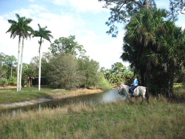
Canal Point, Florida
Closest city: West Palm Beach, Florida.
Travel distance: 44 miles.
Driving directions: Take Florida State Rd. 5 south, and turn right onto Okeechobee Blvd. Merge onto Interstate 95 north via the ramp to Daytona Beach. Take Exit 76 for Florida State Rd. 708/Blue Heron Blvd., and turn left. Make a slight right onto Florida State Rd. 710 West. Turn right onto Indiantown Ave. Turn left onto Florida State Rd. 76 West/Southwest Kanner Highway.
Terrain: Located on 21,875 acres, the DuPuis Management Area is comprised of ponds, wet prairies, cypress domes, pine flatwoods, and remnant Everglades marsh.
History: Native Americans occupied the area beginning in 500 BC; the Seminoles used it as
a refuge during the Seminole Indian War of 1835. More recently, the property was a ranch for Dutch white-belted cattle, sheep, and goats. By 2001, more than 6,500 acres of wetlands on DuPuis were restored through a three-step program. The South Florida Water Management District acquired the land in 1986.
Top ride: Marilee McGinnis of the South Florida Trail Riders of Broward (www.flahorse.com/sftrb/) recommends a 12-mile loop that takes you to the fishing pier and Boy Scout camp.
“This can be a leisurely five-hour ride with a stop for lunch by the lake,” she says. You’ll meander through mostly shaded trails, some of which run along swampy areas. Listen for alligators moving off the bank to the water as you pass.
“When you arrive at the lake, there are covered tables to have your lunch break, and you can also water the horses,” says McGinnis.
Amenities: The reserve has an equestrian area with three barns and several paddocks, as well as water for horses.
Map: Download a trail map at http://tinyurl.com/n4cfdst.
Contact: DuPuis Management Area, (561) 924-5310; http://tinyurl.com/2vmz424.