What state has the most mountain ranges? Is it Montana, Wyoming, or California? No, it’s Nevada! With 314 separate mountain ranges, Nevada has the most ranges of any state in the Continental United States. We’d pictured Nevada as a region of great deserts. While this is true, laced throughout are long ribbons of picturesque mountains. Some rise to heights of 12,000 feet above sea level.
We selected to explore three mountain ranges near the remote center of Nevada. The Toiyabe, Toquima, and Monitor ranges run north and south. The town of Austin is located at the north end of the mountains, and Tonopah is at the south end. These mountains are situated in the Humboldt-Toiyabe National Forest. Three designated wilderness areas are here, as well as three wilderness-study areas.
Mining-Town Gem
Our journey of exploration began at the northern end of the mountain ranges in the old mining town of Austin. We stabled our horses and camped at the roping arena near the town’s west end (775/964-2301 or 775/964-1113).
Austin is located on Highway 50, named “The Loneliest Road in America” by the late award-winning journalist Charles Kuralt. Distances could prove Kuralt correct! Nearest towns are 110 miles to the west, 70 miles to the east, 89 miles to the north, and 117 miles to the south.
Wander up Austin’s main street and soak in the authentic Western atmosphere of better days gone by. This isn’t a commercialized tourist town. Visually and historically, the town is a genuine gem!
Austin began in a mining boom back in the 1860s. The weathered International Hotel is the oldest hotel in Nevada. It was built in Virginia City, Nevada, in 1859 and was moved to Austin in 1863.
The Toiyabe Range
Driving east past Austin, we pulled across Austin Summit and then to Bob Scott’s Summit, where we stopped for a day ride. Bob Scott’s Summit (7,195 feet in elevation) is located at the northern end of the Toiyabes. After trailering for a number of days, we were eager to unload the horses and stretch their legs.
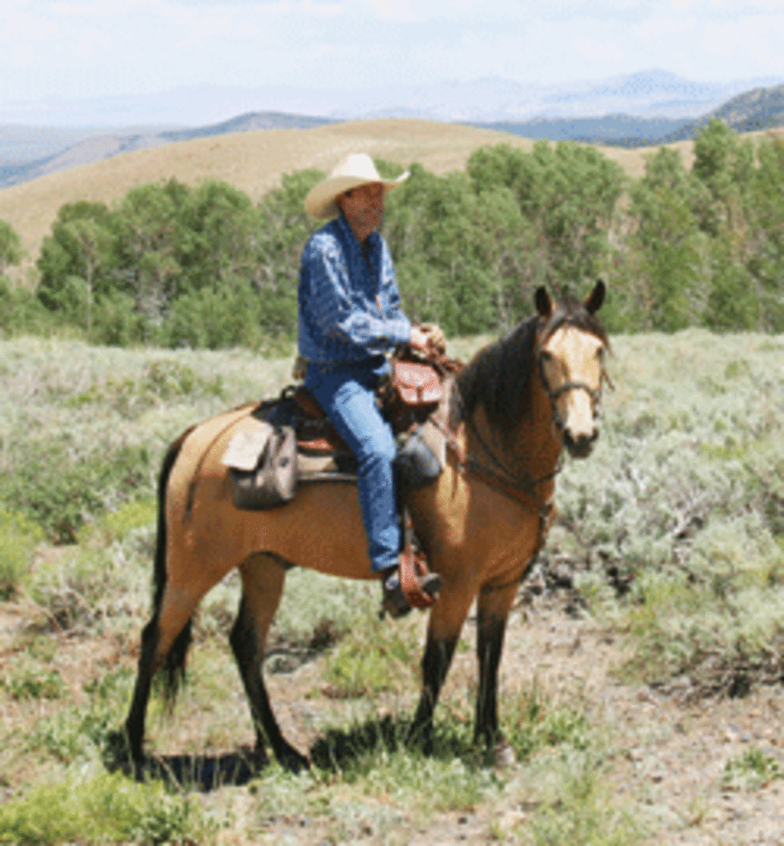
From the summit, we rode our horses south, through a gate, and generally followed old four-wheel-drive roads going southwest. I rode my 7-year-old Missouri Fox Trotter, Buddy, and Charlene was aboard her 9-year-old Fox Trotter, Scout. It was exhilarating to be riding horses “on top of the world”!
Our route took us through open hills, with pockets of cottonwood stands. We rode up toward distant ridges and gained more elevation. From the ridge, we could peer out 100 miles to the rippling horizon. What vast country! We felt as small as pine needles on a forest floor.
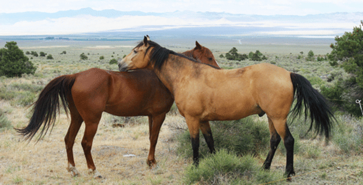
Wildlife here includes elk, deer, black bears, wild horses, bighorn sheep, mountain lions, bobcats, and numerous bird species. Our most interesting wildlife experience was witnessing the yearly invasion of Mormon crickets (actually a type of katydid).
For about two weeks, tens of thousands of brown, plump insects march relentlessly over Austin and its surrounding area. Crickets were here, there, everywhere! Much to Buddy and Scout’s relief, they weren’t interested in horses. However, squashed crickets were cannibalized by their fellow crickets.
The Arc Dome Wilderness is a 115,000-acre primitive mass that drapes across the Toiyabes. We wanted to explore trails out of the South Twin Trailhead, but heavy winter snows and subsequent spring rains had created washouts.
A backcountry U.S. Forest Service ranger told us to keep South Twin in mind for the future. There’s camping space and water at the trailhead. The ranger told us that after a short switchback at the start, the trail follows the South Twin River into some beautiful country with the 11,775-foot Arc Dome Mountain looming as a riding backdrop.
Other trailheads in the Arc Dome Wilderness include Peavine and Tom’s Canyon trailhead on the south end of the wilderness. The same ranger told us not to trailer past the junction of these two canyons. Both canyons are scenic and offer easy riding.
The Cow Canyon trailhead rounds out accesses to the Arc Dome Wilderness. This trailhead is located on the west side of the wilderness. There, you can park your rig in open space among scattered trees. Check with the USFS about water availability, as the area is sometimes dried up.
The Toquima Range
A welcome aspect of this open country is the opportunity to design your own cross-country rides. We did one such ride near the old ghost town of Belmont on the southern end of the Toquima Range.
Two miles northeast of Belmont is a place called Black Buttes. We drove to the back side of the Buttes for a camp that was calendar-scenery special! Imagine a camp between two buttes with a U-shaped window rock and surrounded by an aromatic desert dotted with squatty junipers. Caution: Don’t camp here unless you enjoy solitude and can contend with Mother Nature’s vibrant, twilight color fest! This is a dry camp, so bring water for your horse.
The next morning, we prepared a lunch, saddled the horses, and rode off on a 10-mile loop ride to the mountains in the western horizon, into the town of Belmont, and back. While riding steadily through stands of juniper, we occasionally flushed rabbits from the underbrush.
At the base of the low mountains, we turned south and worked our way northwest of Belmont to the area around Mount Priscilla. This is an interesting area, with a number of rock formations and boulders seemingly piled in a haphazard manner. Facing an apparently difficult route forward, we turned back and followed a deteriorating road into Belmont.
Belmont is an old mining town. Tie up your horse, wander around, and explore the long deserted stone, brick, and frame buildings. The grandest relic is the former Nye County Courthouse, a two-story brick edifice surmounted by a square cupola. This building was constructed in 1876 and is now a state historic site.
Don’t expect much in the way of public services. There was no vehicle fuel when we were there, but there was a saloon. Happily, we rode over and tied up, salivating at the thought of a cold brew. Much to our dismay, the front door was padlocked. A handwritten note, signed by the bartender, stated he would be back after lunch. The note was dated two days earlier!
Up the street is the Belmont Inn. This antiquated bed and breakfast was built in 1866. We toured the quaint rooms filled with doily-covered settees and imagined the tinkle of glasses, the rustle of feet, and the murmur of voices from a bygone era. The Belmont Inn remains open today (775/482-2000; www.belmontinn.com).
Riding out of town, we followed a marked mountain-bike trail up a ravine and to the right around a low ridge. In the distance, we could see Black Buttes, where our camp awaited. Our horses took us cross-country over low hills and through dry, meandering streambeds. Century-old tree stumps stood in mute testament to the logging done to supply Belmont’s firewood.
The Monitor Range
From Belmont, we drove east across a valley on dirt roads to the Monitor Range. Our goal was Barley Creek horse camp at the edge of the Table Mountain Wilderness Area. The roads were good until we got within the last five miles, which slowed us with deep ruts and multiple stream crossings. With our heavy vehicle pulling a trailer, it took us 50 minutes to do those last five miles!
However, Barley Creek horse camp made it all worthwhile. The camp is nestled in a small valley, surrounded by juniper- and cedar-covered mountains, and completed with a fine trout stream. There are two sets of corrals. From this point, if you drive across the creek one more time, there are additional camping sites. For three days, we were the only ones there.
The Table Mountain Wilderness Area adjoins Barley Creek horse camp. It’s nearly 100,000 acres and reaches elevations up to 9,000 feet. Much of the wilderness is a high plateau, giving way to valleys and canyons.
Some of the largest aspen stands in the state of Nevada grow around Table Mountain, creating a unique environment. This region supports one of the most productive mule deer herds in the state and also a herd of about 300 elk.
Our first ride was east up Trail 37, Cottonwood Creek. We hadn’t ridden very far when we were met with severe washouts and erosion. Heavy snows had released a devilish torrent of spring rains that had erased the trail. When it’s repaired, this trail will undoubtedly provide a pretty ride.
The next morning dawned crisp and clear. Even though we were surrounded by hot deserts in the basins below, our overnight temperature at camp was 37 degrees. Buddy and Scout were glad to feel the comforting blanket of warm morning sunlight.
After breakfast, we struck north on Trail 38 up Barley Creek. This time, we skirted washouts and were able to have a good day ride into the backcountry wilderness. Shortly after departing, we came across a rock corral. We theorized this must be a remnant from an early homestead.
Our travels up Barley Creek took us through a scenic canyon with rock walls, hillsides, and juniper trees. After several creek crossings and about three miles, we came to a big meadow going off to the left. The trail divided, and we took the left-hand route, but the trail soon disappeared.
Returning to the junction, we rode up the right-hand trail and shortly came to a junction, where one trail went east and connected with the Cottonwood Trail. This could provide a loop when the Cottonwood Trail is repaired. Continuing straight ahead (or left at the Cottonwood junction), we rode across the stream several times, past beaver ponds, and arrived at a shady place among cottonwood trees for lunch.
Following our lunch break, we rode further up the valley, then climbed in earnest up several switchbacks, gaining quick elevation. After the switchbacks, the horses did one last pull and came out on top of the Table Mountain Plateau.
At 9,000 feet in elevation, we were treated to a smorgasbord of visual delights. What a great moment to share with our equine partners! Without them, we wouldn’t have experienced this.
From our vantage point, we could look directly across the valley to the Alta Toquima Wilderness Area and the nearly 12,000-foot peaks of Mount Jefferson. Near the top of Mount Jefferson is the highest ghost town in North America. And just discovered in 1978 are the remains of a 7,000-year-old Indian village, where you can still find circular and linear rock alignments, and the remains of dwellings. The access to this area is extremely rugged and not recommended for horses.
Closer to where we were standing at the moment were remains of another historic Indian structure known as the Serpentine Wall. This structure is a network of low-lying stone walls that date to 50 BC. Archeologists believe the walls functioned as a prehistoric drive system for trapping sage grouse.
Charlene and I thought we were within one or two miles of this structure. However, our search for it was cut short by ominous storm clouds gathering in the distance. Even Buddy pricked up his ears at the wisp of cooler air. You don’t want to be at 9,000 feet on an exposed plateau in a lightning storm!
Buddy and Scout turned tails and began a quick descent down the switchbacks into Barley Creek Canyon. We found a sheltered place to wait out the lightning storm. The sky darkened while lightning struck on both sides of our canyon. As the storm passed, we could hear the thunder worrying around and muttering to itself. After this we made safe passage back to camp.
Mustang Outfitters
If you’re a little concerned about the adventure of trail riding in remote country with possible trail difficulties, Mustang Outfitters (775/964-2145; www.mustangout fitters.net) could be the way to go. Or, if you want to be wild and ride the length of these mountains on a custom pack trip, Mustang Outfitters is really the way to go!
Mustang Outfitters is located out of Round Mountain between Austin and Tonopah. It specializes in traditional horse pack-in trips. You decide how long the trip will be, then it provides everything you need except your personal gear.
Mustang Outfitters also goes the extra mile in doing something that most outfitters frown on: It allows you to bring your own horse or mule. Most of the riding is between 7,000 and 10,000 feet, so if you do bring your own mount, make sure he’s mountain savvy, acclimated and in top physical condition.
One popular trip is the Toiyabe Crest Trail, constructed by the Civilian Conservation Corps in the 1930s. It’s not for the faint of heart; the outfitters only take riders with riding experience.
The trip traverses some of the highest elevations in the region with panoramic views. It’s a progressive pack trip, meaning it’s packed and moved every day. Because of this, you’ll pack light and use dome-type tents. High vantage points offer unobstructed views of distant mountains and the valleys below. You might spot elk, bighorn sheep, mule deer, and even wild mustangs. In fact, Mustang Outfitters offers mostly native Nevada mustangs as riding mounts.
End of the Trail
After working our way through the central Nevada mountain ranges, we emerged into the warm deserts around the town of Tonopah. We stopped in town to stock up on supplies and plan the next segment of summer fun for the boys (our horses) and us.
Sometimes, we wonder if the boys tire of hauling us around while we check out new places. But we always see excitement in their faces, feel their quick pace as they head out on a new trail, and sense their never-ending curiosity about what lies over the next hill.