
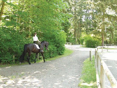
Bridle Trails State Park, Kirkland, Washington
Closest city: Seattle, Washington.
Travel distance: 25 miles.
Northbound directions: Take I-405 to Exit 17. At the end of the off-ramp, turn right, and head south on 116th Ave. NE. At the four-way stop, continue straight ahead. The park entrance is located at the first opening in the trees on the left.
Southbound directions:Take I-405 to Exit 17. At the end of the off-ramp, turn right, and cross over the interstate. At the first light, turn right again. Head south on 116th Ave. NE. At the four-way stop, continue straight ahead. The park entrance is located at the first opening in the trees on your left.
History: The area that’s now Bridle Trails State Park contains public land owned by the state of Washington since the 1880s. By the 1930s, the park had become a popular area for riding, and local riders developed a trail system. Concerned about protecting the land, citizens petitioned the state legislature to make the area a state park. Today, local equestrians and other park users work to maintain and improve the park’s 28 miles of trails.
Terrain:The park is located in a lowland forest, typical of the vegetation that once covered Puget Sound. The woods are mostly Douglas fir and western hemlock, with some western red cedar, big-leaf maples, and alders. Two arenas are also located within the park.
Map: Visit the Bridle Trails website, www.bridletrails.org/trail_map.html.
Top ride: Start at the one-mile Raven Trail, near the park entrance. This will lead you to the 1.6-mile Trillium Trail loop. From the loop, near the Little Ring, get onto the Coyote Trail, which runs 3.5 miles through the woods. The Coyote Trail hooks up again with the Trillium Trail loop.
In the saddlebag: Bring insect repellent, sunscreen, and a camera.
Contact: Bridle Trails State Park, (425) 307-3578; www.bridletrails.org.
Flying R Ranch, West Plains, Missouri
Closest city: St. Louis, Missouri.
Travel distance: 65 miles.
Directions: From St. Louis, take I-44 west to Rolla. Then take U.S. Rte. 63 south about 65 miles to Cabool. Continue on U.S. Rte. 63/U.S. Rte. 60 east to Willow Springs. Take Missouri Rte. 76 west to Missouri Rte. 181 south. Go to State Hwy. AA, and turn right. The ranch is on the right.
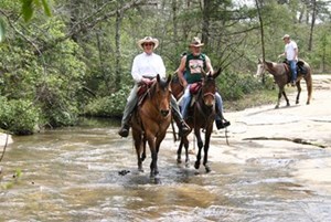
History: The Flying R Ranch is located in the heart of the Ozarks andThe Mark Twain National Forest. The Mark Twain National Forest, Missouri’s only national forest, was established on February 17, 1976. It encompasses roughly 1.5 million acres, mostly within the Ozark Highlands. Located across southern Missouri and northern Arkansas, the Ozark Highlands are an ancient landscape characterized by large, permanent springs, more than 5,000 caves, rocky barren glades, old volcanic mountains, and abundant streams.
Terrain: Flying R Ranch offers a variety of trail types and varied terrain. Nearly all the trails leave camp via three main trails near the stalls. You can meander along the North Fork River and begin your adventure after crossing the water. Trails are marked withred, yellow, orange, green, and pink ribbons, and colored lids and arrows.
Map: No map available. Contact the Flying R Ranch for trail details.
Top ride: For a day ride, take the Green I trail, and cross the lodge road. Continue on the Green 2 trail, marked by a second section of green ribbons. This trail runs along open fields, then switchbacks down a long hill and follows the perimeter of the ranch’s north side along the fence line. Take a break under the trees and enjoy the shade before winding alongside a small pond. The trail continues into the meadow, then connects with Buzzard’s Roost Trail, marked in yellow.
In the saddlebag: Bring insect repellent, sunscreen, and a rain slicker.
Contact: Flying R Ranch, (417) 469-2267; www.flying-r-ranch.com.
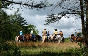
East Fork Stables, Jamestown, Tennessee
Closest city: Knoxville, Tennessee.
Travel distance: 89 miles.
Directions from I-75: Drive north into Tennessee, then take Exit 141 (Oneida/Huntsville and Hwy. 63 Exit) to Hwy. 63. Continue to Hwy. 27 and go south to Elgin, then turn right onto Hwy. 52. When you get to a four-way stop in Allardt, turn left on Hwy. 127. Go a couple of miles; the stables are on the right.
Directions from I-40, between Nashville/Knoxville: Take I-40 to Exit 317 (Crossville/Jamestown and Hwy. 127). Go north on Hwy. 127 for 28 miles. The stables are on the left.
History:East Fork Stables is located on the western edge of the Cumberland Plateau, which was used as hunting grounds by the Cherokee and Shawnee until around 1800. Although the tribes found the area rich with game, such as deer, elk, and buffalo, they never settled in this region.
East Fork Stableshas been owned by the Gerndt family since the last 1800s, but onlyopened to the public in 1994, when it was quickly established as a premier trail-riding venue.The 12,000-acre tract of land that containsEast Fork’s 100-plus miles trail system offers a diverse selection of attractions and amenities.
Terrain: East Fork terrain encompasses shady forests, sandy trails, open fields, rock formations, waterfalls, lily-pad ponds, and flora along riverbanks accessible only by horseback. The trail system is vast and scenic.
Map: Visit the East Fork website, below, and click on the “Trail Map” link.
Top ride:The 6.8-mile Deer Gap Trail rewards you with views of Jordan Lake, bluff views, and a beautiful waterfall.
In the saddlebag: Bring insect repellent, sunscreen, a rain slicker, and a camera.
Contact:East Fork Stables, (800) 97-TRAIL [87245] or (931) 879-1176; https://eastforkstables.com.
Audrey Pavia (www.audreypavia.com) is a freelance writer based in Norco, California. She’s the author of Trail Riding: A Complete Guide (Howell Book House) and Horse Health & Nutrition for Dummies (Wiley). Pavia rides competitive trail with her 9-year-old Spanish Mustang, Milagro.