
Whether you plan to bring your own horses and your living quarters to explore mountains and wilderness on your own or prefer to be pampered at a local guest ranch where you can enjoy a variety of horse-related activities, there’s something for everyone in Dubois, Wyoming.
Getting there
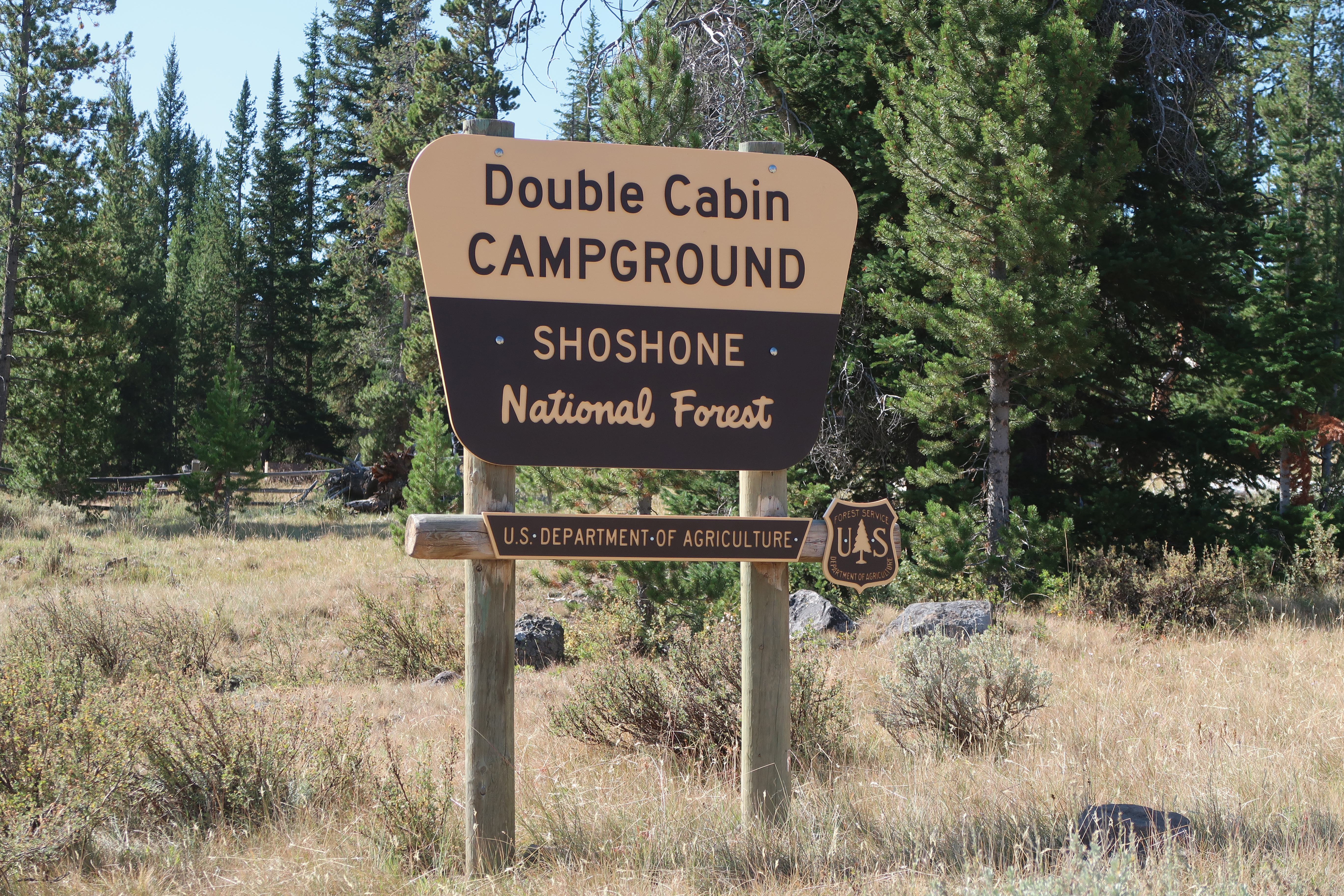
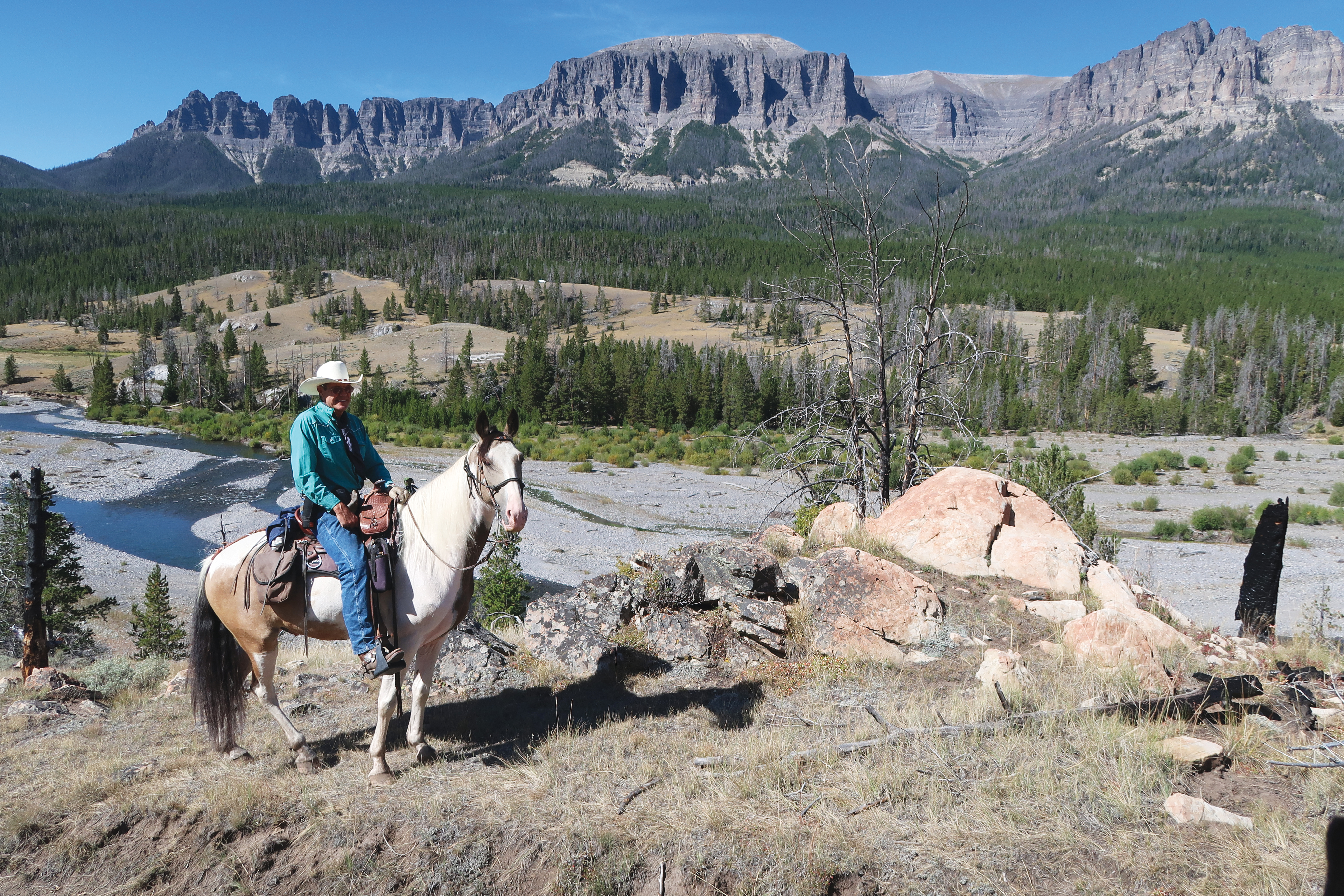
We traveled with our living-quarters trailer and our two geldings, Cody and Jake, to check out the riding opportunities around Dubois. One place that was high on our list to experience was the Double Cabin Campground in Sho-shone National Forest. We heard this was as close as you could get to a real wilderness adventure without having to pack into one.
From the town of Dubois, it’s 24 miles of dirt roads on mountainous terrain to the campsite and trailhead at Double Cabin. Before you head to Double Cabin, though, make sure to grab any fuel or supplies in Dubois as that’s the last outpost of civilization before you reach your destination. Note: Because you travel on dirt roads in the mountains to get to the trailhead, we recommend calling the United States Forest Service, (307) 455-2466, in advance to ensure the road conditions are safe. We were fortunate, the road had just been graded when we hauled our living quarters there. But even with that, it took 1 1/2 hours, pulling our living-quarters trailer, to drive the 24 miles to camp. And yes, there are some hairpin turns!
To get there from town, you’ll want to take Horse Creek Road and travel north. Pavement ends in about 5 miles, and the road then becomes forest service road 285. Follow this route into the enveloping tranquility of the southern Absaroka Mountains.
Double Cabin Campground
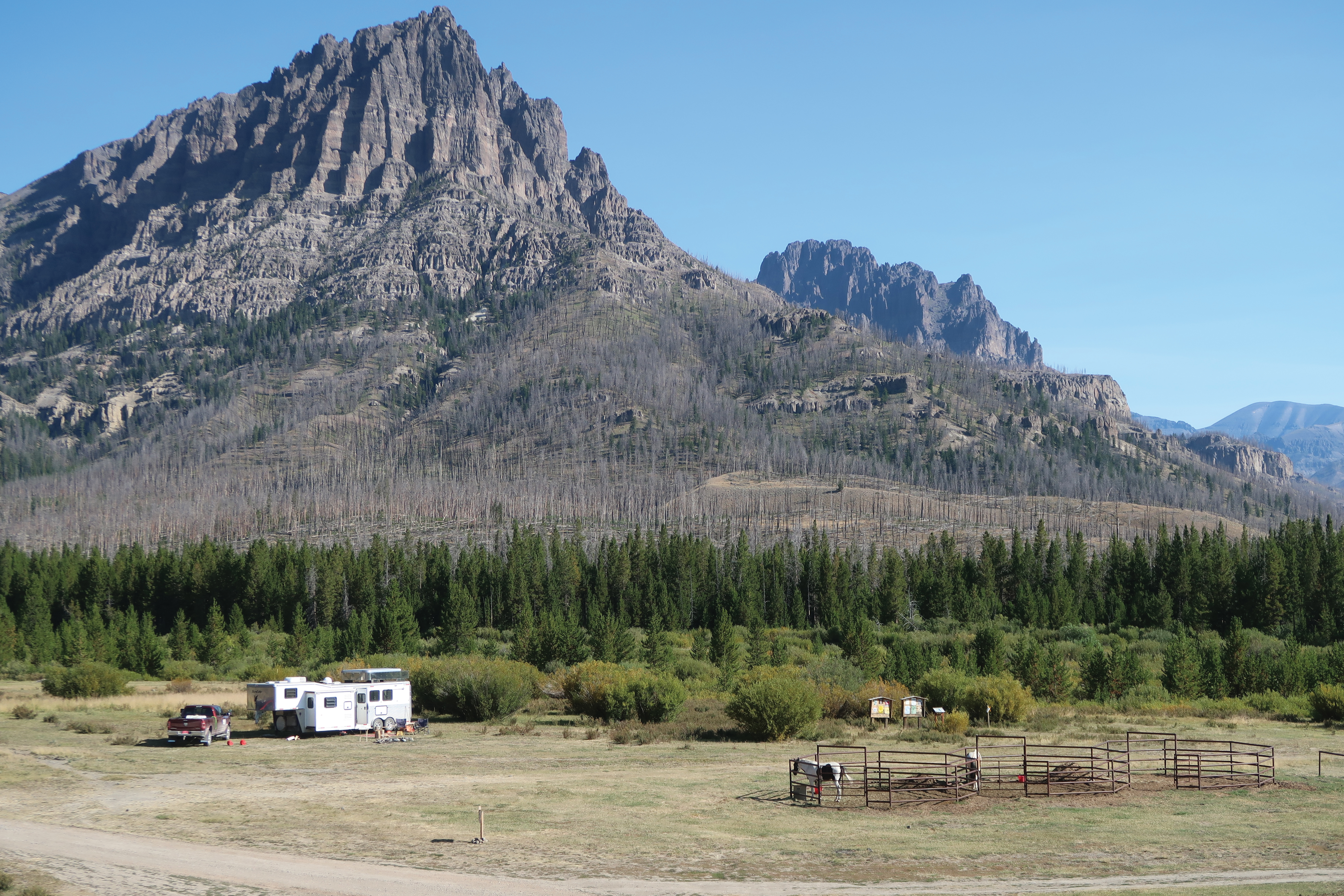
When you arrive at Double Cabin, turn left at the junction if you want dispersed camping without corrals. If you’d like corrals for your horses, turn right, drive past the Forest Service campground—which is not open to horses—and continue to the public corrals. There are three sets of corrals with three spacious corrals in each set. Horse water can be bucketed from a nearby creek, so be sure to have a few buckets in your trailer before you head to Double Cabin. In the Forest Service campground, there is one slow hand pump. We have a 65-gallon water tank in the back of the truck for horse use, and it took quite a while to fill the tank with the hand pump.
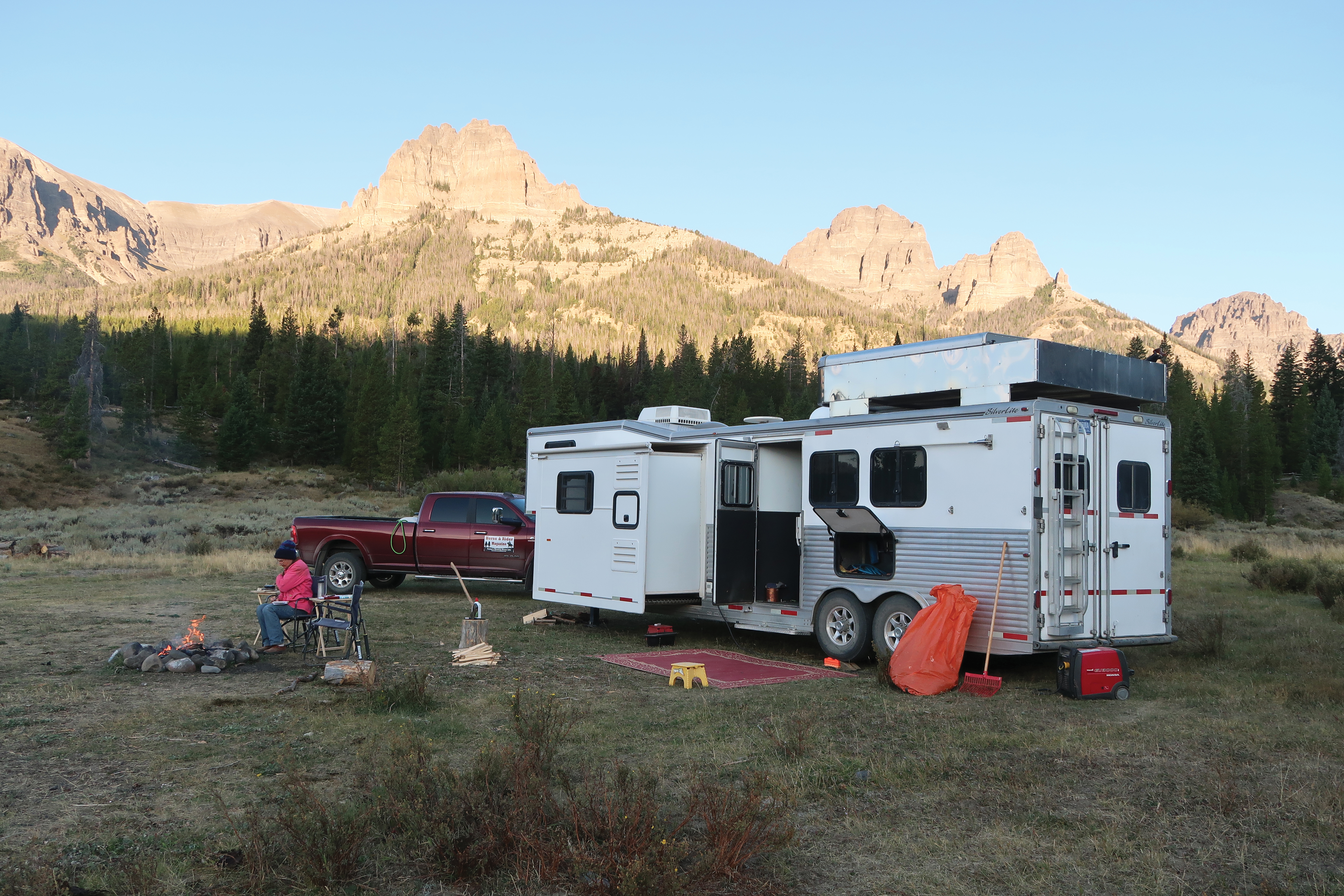
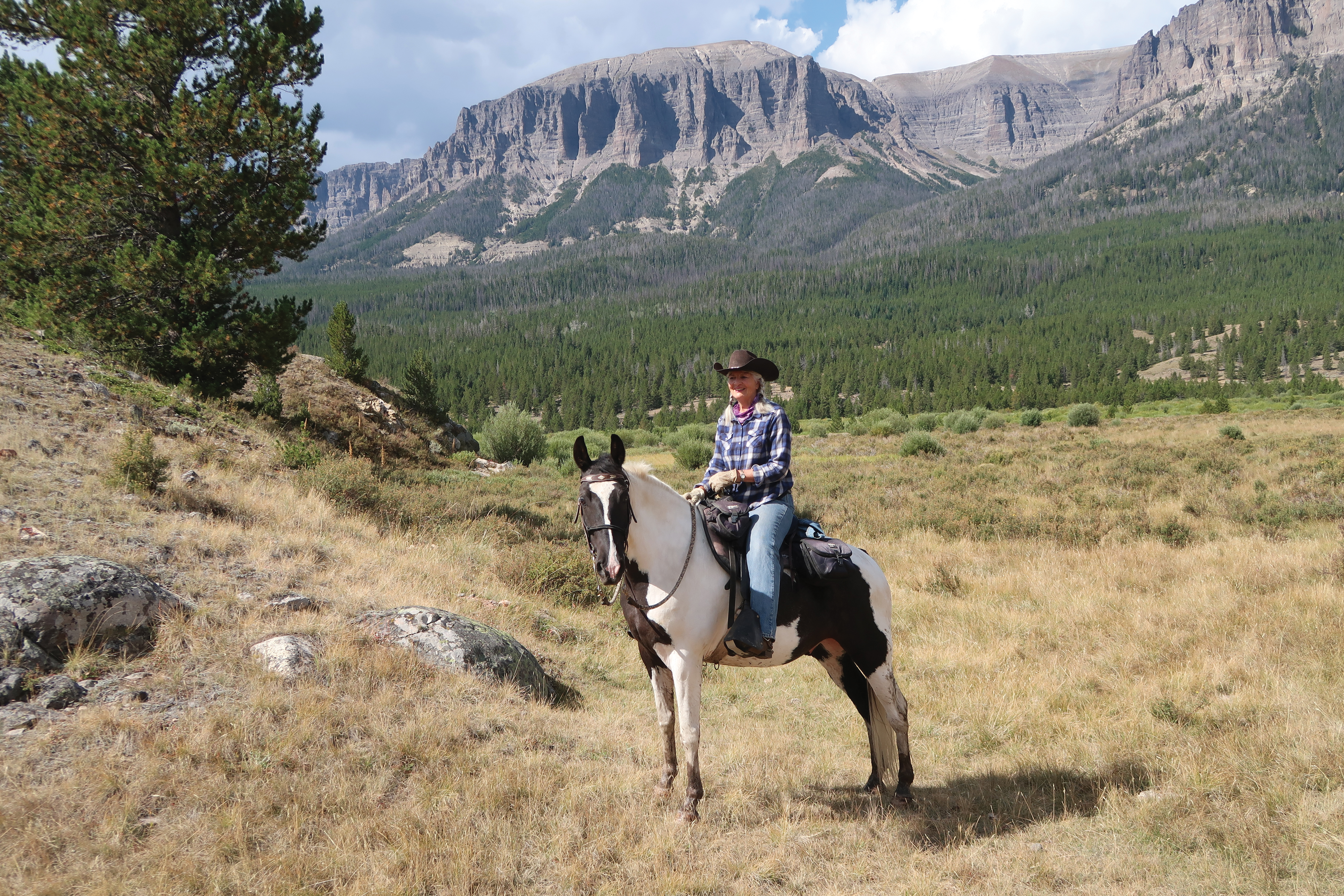
One could not ask for a more visually stunning location. The camp is set at 8,000-feet elevation in a glacial-carved bowl, surrounded by 11,000-foot craggy mountains. Nothing fills the soul more than to sit outside before dawn and watch the sun creep down the mountains, pausing to bathe each peak with a golden glow. In the nippy mornings we warmed our hands by the crackling fire, watched the horses munch hay, and listened to the mournful wails of distant coyotes.
The camp is surrounded by a designated wilderness area, the Washakie Wilderness. This area covers 704,529 acres and is named in honor of Chief Washakie, a leader of the Shoshone Indians.
The wilderness area is a special place that’s managed to maintain its wild and natural character. Here the imprints of human activity are minimal. Visitors may experience these wild places and enjoy pristine lakes, tumbling waterfalls, slopes awash in wildflowers, cloud-shrouded peaks, glacier-carved valleys, and a plethora of wildlife. However, motorized vehicles are not allowed.
Weather changes here can be extreme and sudden. Snowstorms and freezing temperatures occur every month of the year, and thunderstorms are common during the summer months. During our September stay, the daytime temperatures were in the 60s but dropped to freezing at night. You and your horse should come prepared for all weather possibilities.
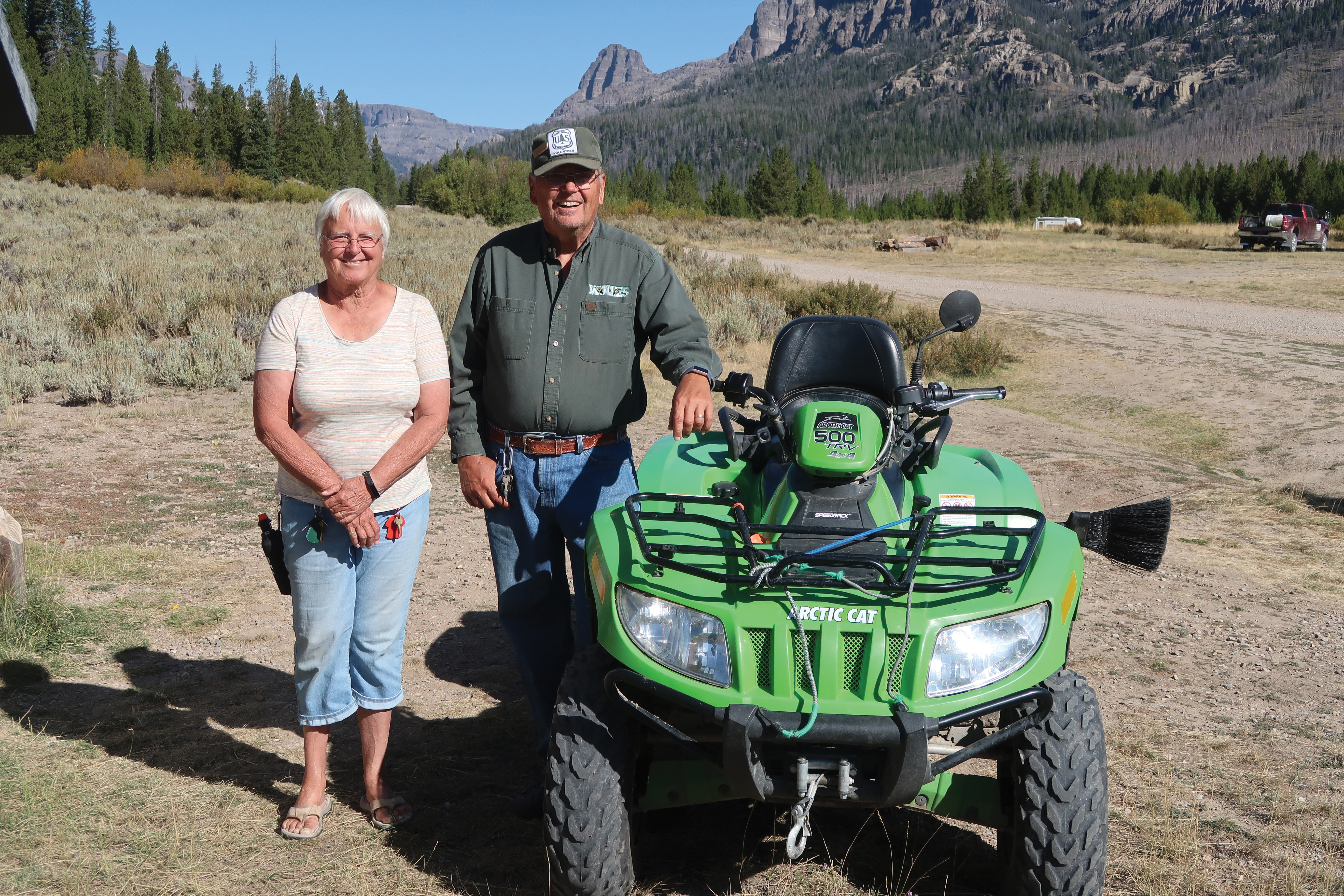
Bev and Arvil Ashment of Basin, Wyoming, are the campground hosts in the nearby Forest Service campground. Amazingly, they’ve been coming here since 1969. Bev’s father brought her here as a child, and her love affair for the area has continued throughout her life. Both are enthusiastic sources of local information.
Frontier Creek
There are four rides from camp, each with its own unique personality. Our first ride was up Frontier Creek. None of the trailheads are very well marked, but the campground hosts will be happy to point you on your way. Ride back past the Forest Service campground and look for an unmarked trail cutting the large meadow northwest of the campground. Follow this trail down to Frontier Creek and cross the creek to the trail going up Frontier Creek.
You may see samples of petrified rock and tree stumps on this ride. Volcanic eruptions of the Yellowstone National Park area added layers of ash to this land. Time and pressure mineralized the entombed trees. Water and erosion then excavated these trees leaving exposed petrified tree stumps. You may find pieces of petrified wood along the trail or in streambeds. In the past, petrified wood was carried out by visitors, even commercial entities. Entire petrified trees were dynamited and carried out by mule pack trains. Now all petrified wood is protected in designated wilderness areas.
The first 6.5 miles of trail travels through fairly level land in a forest consisting predominantly of lodgepole, so named because Native Americans used the trees to build their lodges. We had to work around several large fallen trees on our journey. After around 7 miles, you get to the Cougar Pass intersection where there’s more fir and spruce. Through the trees you can see gray volcanic cliffs.
About 2 miles past the Cougar Pass intersection, start scanning the cliffs to the west and you should be able to see petrified tree stumps dotting the gray rock. Another strange anomaly, supposedly in this area, is the Devil’s Graveyard. It can be seen on some older maps, and is alleged to be a high hidden meadow where flat stones lie perpendicular to the ground forming a natural tombstone cemetery. We talked to a local horseman who tried several times to find it and failed. It remains to be discovered.
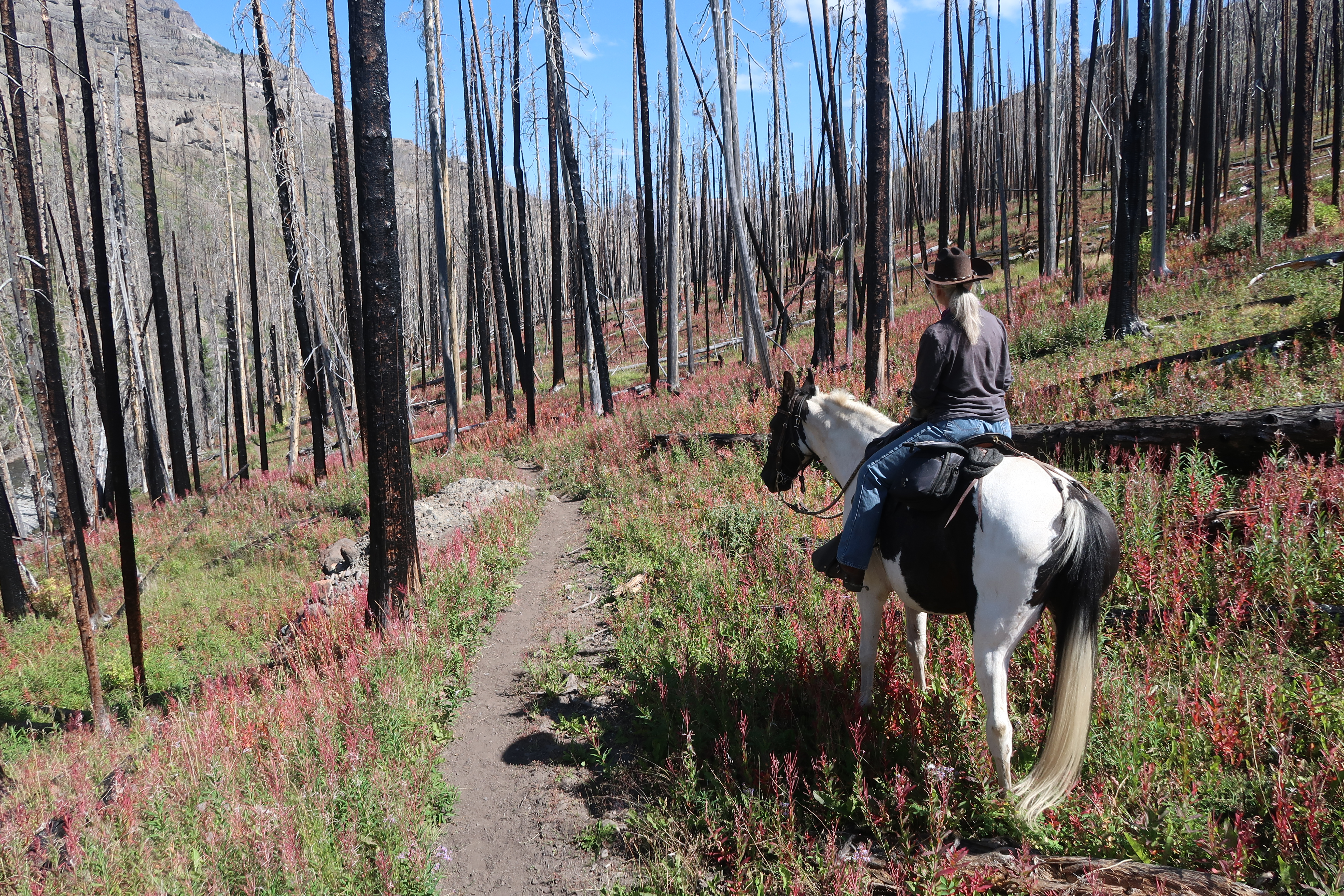
Wiggins Creek
Our second ride was up Wiggins Creek. Jack Wiggins was a local homesteader, and liked the country so much, that when he packed surveyors into the area in 1900, he gave them a quarter beef to name the creek after him.
To find the trail, cross the stream north of the corrals. Follow horse tracks through a long stretch of gravel to the willows on the far right and ride up into the flat. You should find a signed intersection. At this intersection, turn left and north to ride up Wiggins Creek.
This entire drainage was burned by a forest fire in 2011. The negative aspect of this is that you’re riding through tree snags. The positive aspect is that you’re able to see out to the mountain ranges and distant scenery on both sides of the trail. After several miles in, look for rock towers on both sides of the trail. At about the 5-mile mark, the trail divides between the Emerald Lake trail to the left and Wiggins Creek to the right. It’s about 14 miles from the trailhead to Emerald Lake making for a very long day ride or an enjoyable overnight pack trip.
The headwaters of Wiggins Creek and Frontier Creek are home to one of the largest Rocky Mountain Bighorn Sheep herds in North America. During our September stay three groups of bow hunters were packing into the high country on horseback for a 10-day sheep hunt. Sheep hunting is nothing new here. For hundreds of years in the past, Sheepeater Native Americans built enclosures to capture sheep. They were used for food and clothing, and the bones were used for eating utensils and tools. You can learn more about bighorn sheep at the National Bighorn Sheep Interpretive Center in Dubois (bighorn.org).
Bug Creek
Our third ride was to Bug Creek. This ride begins like the last ride; go across the stream to the signed intersection in the flat. Once in the flat, ride to the right, towards the scar of an old fire road on the hillside. You’ll continue following this route, and in roughly a mile you’ll come to a signed intersection. Bug Creek is to the left, and Indian Point, our next ride, is to the right. Parts of this trail consisted of an old, unused fire road. Our route gained elevation as it serpentined through open country that was splashed with pockets of timber. Finally, we reached the pass for Bug Creek where the scenic Caldwell Basin sprawled below.
If you continued down Bug Creek to Bear Creek and followed it over Bear Creek Pass to the Wood River, you would arrive at the site of the famed aviatrix Amelia Earhart’s cabin. However, this is too far for a day ride and is better accessed from the other side of the mountains. Earhart loved this area, and in 1937 her friends began building a summer cabin for her. Unfortunately, that year she was lost on her around-the-world flight. Nothing remains today except for some log foundations.
On our return trip, we encountered a severe thunder and lightning storm. We retreated to a small group of trees to wait the storm out. Lightning storms are common in the afternoon in the high country. If lightning is imminent, avoid hilltops and open country, and work your way to lower ground; generally, lightning will strike the tallest object within 50 feet. Don’t take shelter under a lone tree; find a small group of trees, preferably surrounded by even larger trees.
After the pelting rain, we started downhill. The trail soil consisted of clay which, when wet, adhered to the horses’ hooves like gluey oatmeal. Soon we were sliding downhill like a winter sled ride. We had to dismount and walk for a while. Fortunately, this type of soil dries quickly after rain stops.
Indian Point Trail
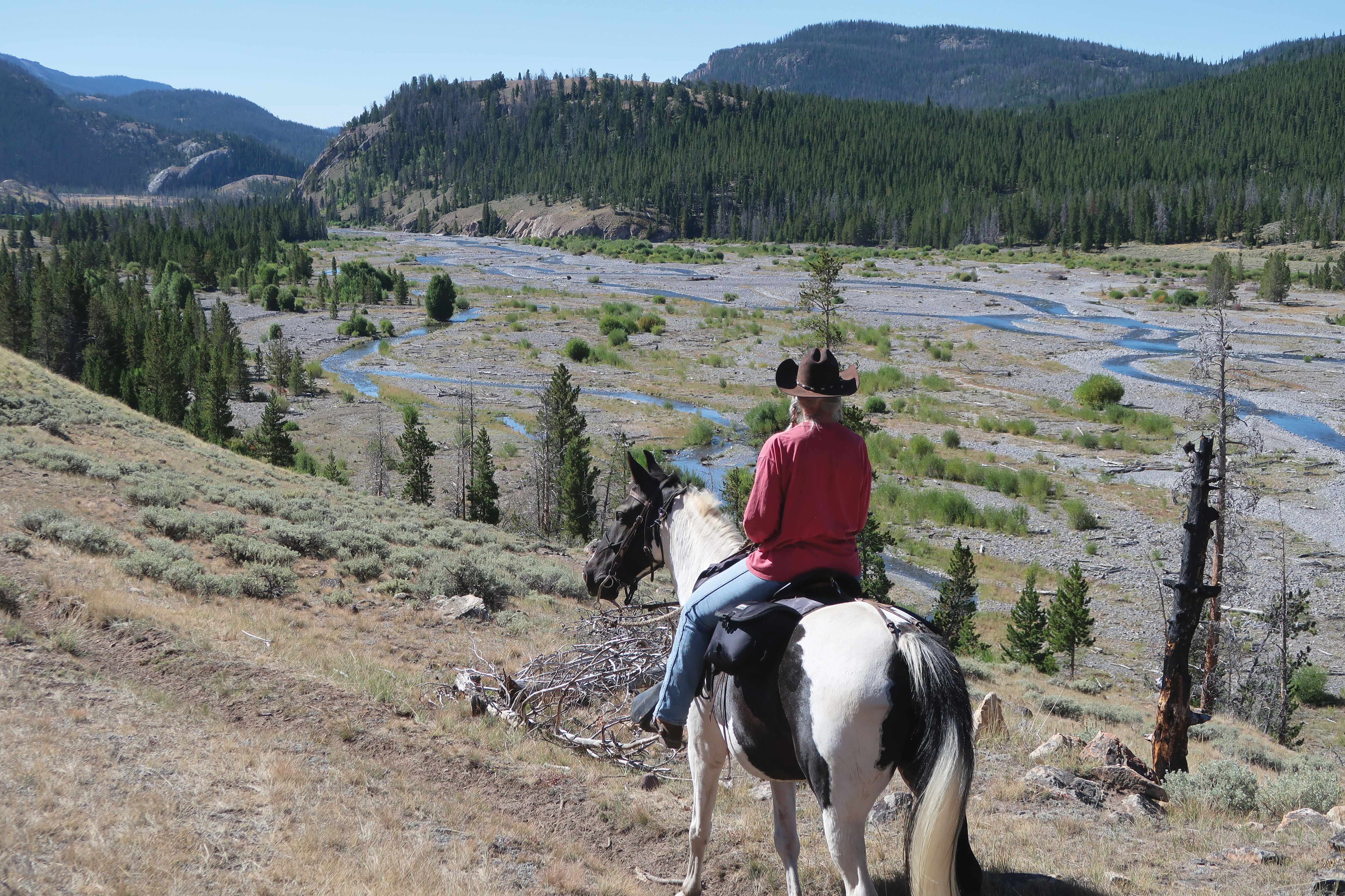
Our fourth and last ride, we rode the Indian Point Trail. The access to this trail starts out the same as Bug Creek Trail, but you’ll turn right at the signed intersection. The first portion of this trail follows a flat along the river where the trail disappears and reappears. Keep following the trail, and it’ll soon start up an open valley to the left. The part of the trail along the river provides good access for fishing.
While riding along the river flat, we encountered a lone sandhill crane. This crane followed us for a while and made loud squawking noises something like a trumpeter call. Standing around 5 feet tall with a wingspan of up to 7 feet, it appeared to be quite a formidable creature to our horses. Both Cody and Jake were briefly startled but relieved when the crane gave some final squawks and lifted off the ground.
The first part of the trail uphill is in an open valley with terrific views back to Double Cabin; the views to the right of jagged peaks reminded us of our trail rides in the Canadian Rockies. About 3 miles in, the trail drops and crosses Caldwell Creek, then works its way up through mostly timber to Bear Pass, not to be confused with Bear Creek Pass.
On this ride we encountered fresh grizzly bear tracks. Grizzlies are increasingly common in the Northern Rockies and demand great respect; they can weigh up to 600 pounds or more and may attack without warning.
When in bear country, look for bear signs such as scat, tracks, claw marks, diggings, or log and stumps torn apart. Six heartbeats are generally considered a safer number for travel in grizzly country. That includes humans, horses, and dogs.
In bear country, you should always carry bear spray and check the expiration date prior to heading out on your ride. If you need to use it at any point, aim for the bear’s abdomen because the spray will rise up, and he will get a face full. It’s recommended to spray about 25 feet from the bear and spray for at least 6 seconds.
It’s almost unheard of for a horseman to be attacked by a grizzly, providing you stay in the saddle. Most encounters involve an element of surprise.
If you’re in grizzly country and are in dense brush or thick trees, give a shout now and then. If a grizzly charges you, don’t run. Continue facing them, but don’t look them in the eyes, and slowly back away. They’re a majestic part of the wilderness, but one that we only want to view from a distance.