In a designated wilderness, earth and its community of life are untrammeled by people. It’s affected primarily by the forces of nature, and is large enough to assure that it can be preserved and used in an unimpaired condition.
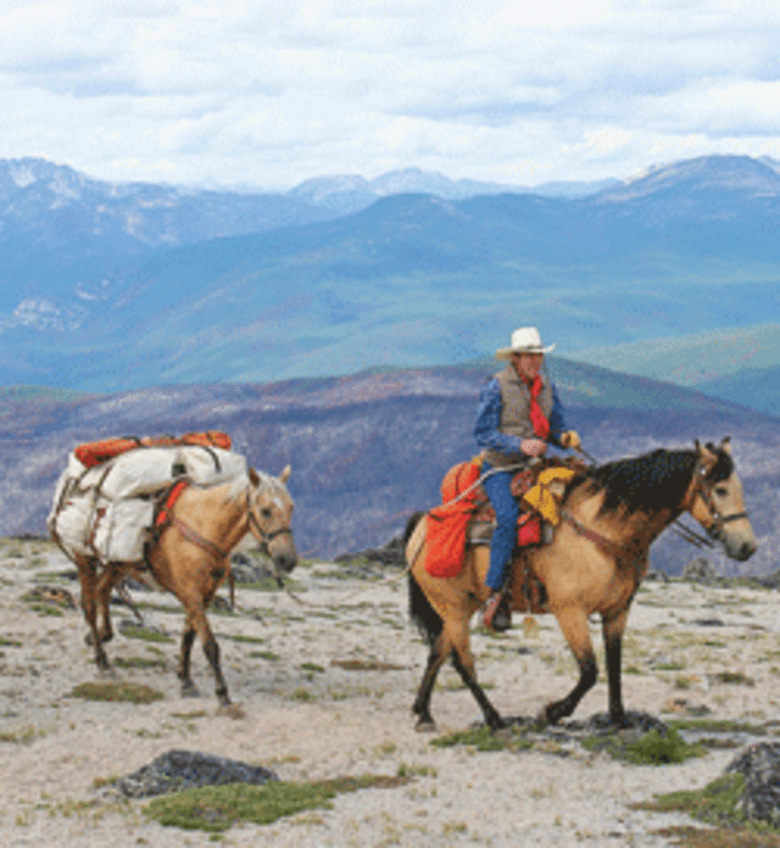
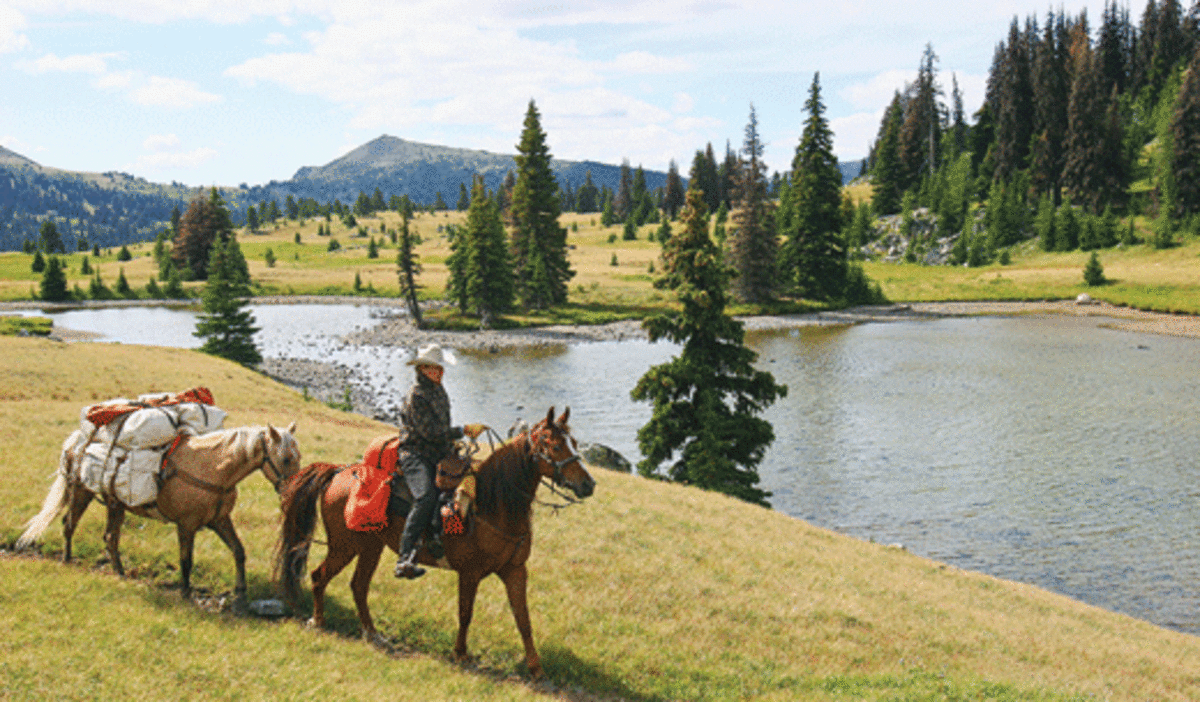
Wilderness to us also means a region large enough to be difficult to reach on foot, but practical to explore by horseback. We selected Washington’s Pasayten Wilderness Area for a nine-day horse-packing trip.
The Perfect Loop
A good mate, a good horse, and Mother Nature. These ingredients make a pack trip special. We were ready to ride into the Pasayten Wilderness.
The Pasayten contains more than one-half-million acres of designated wilderness. Combined with North Cascades National Park and Ross Lake National Recreation Area to the west, and the Canadian roadless areas to the north, the region has more than one million acres of wild lands. It takes about 460 miles of road to drive around it.
Our trailhead was at Long Swamp Campground, west of Tonasket, Washington. We planned a perfect loop: riding north from the campground to Horseshoe Basin, west to Remmel Lake, and southeast to our point of origin.
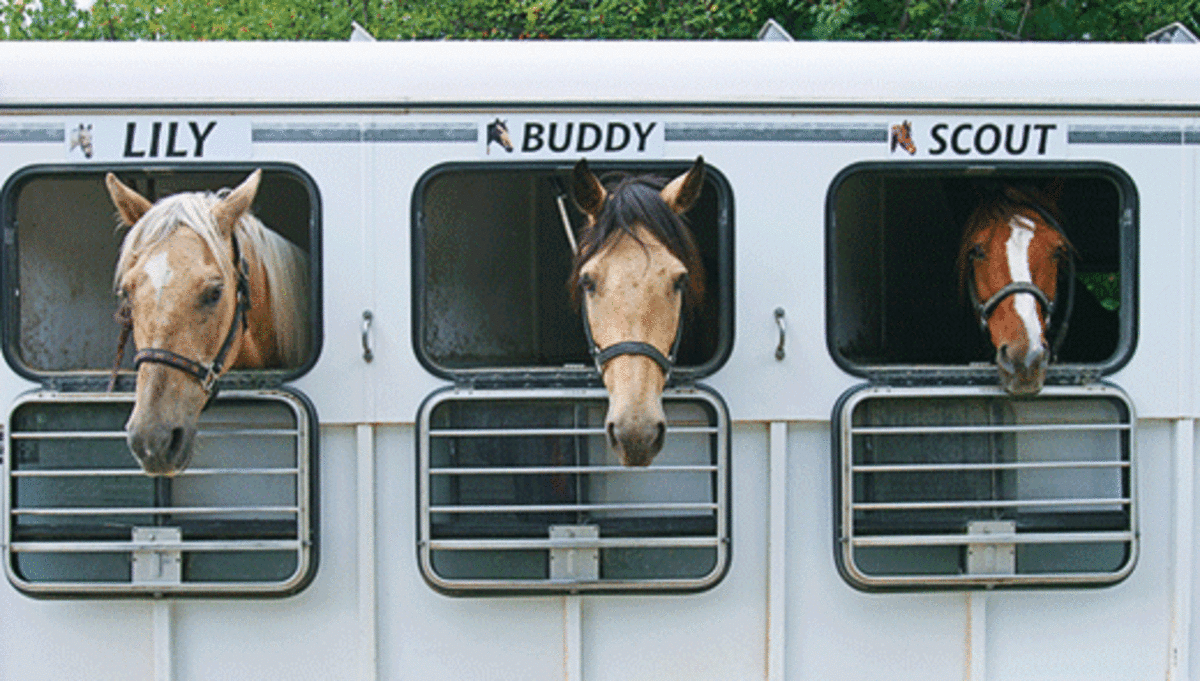
The cast of characters on our trip included my 8-year-old gelding, Buddy, Charlene’s 10-year-old gelding, Scout, and our 15-year-old pack horse, Lily; all Missouri Foxtrotters and pack-trip veterans.
We’ve never traveled with guides or outfitters and generally travel through wilderness by ourselves. Alone, we bond deeply with our horses, and have an almost spiritual experience as we travel quietly through wilderness. We live every minute and enjoy every minute we live.
In the morning stillness with air freshly scented by pine, we began riding north on Trail #342. Our horses’ heads were held high, proud. Their rhythmic plodding kept company with our wondrous thoughts of anticipation as we switchbacked up the hill.
Soon, we entered an area burned by a recent forest fire that covered 175,000 acres of the wilderness’ southeast portion. Looking like an incinerated moonscape, the land was punctuated with new grass and flower growth. Nature was struggling to regain the soil.
This first day, our task was to cross Windy Peak and get to our campsite at Horseshoe Basin. The elevation at the trailhead is 5,600 feet above sea level; Windy Peak tops out at 8,334 feet. Our horses had their work cut out for them.
After four or five miles, our climb to the peak began in earnest. At the same time, the trail disappeared! If you take this trail, look for rock cairns. Follow rock pile to rock pile as they lead you out of the trees and above timberline.
A backcountry ranger told us to be wary of a sandy chute area just before the top of Windy Peak that’s often blocked by snow. If a snow bank is present, don’t cross it or you’ll risk sliding into the abyss hundreds of feet below!
Fortunately, the snow had mostly melted, and we were able to cross the chute. Even so, this is no place to tarry, as the trail is narrow and a slide to the bottom would be unforgiving.
If this chute is blocked by snow during your ride, work to the left, circle around the small mountaintop, and work again to the right. Shortly, you’ll come out beyond the chute on the saddle that lies just below the point of Windy Peak.
By this time, we’d climbed 2,730 feet in about seven or eight miles from our starting point. This is a wonderful place to pause and take in the unparalleled beauty that unfolds in 360 degrees of vistas. We could see south to the Okanagon National Forest, north to Canada, and west to North Cascades National Park.
While descending Windy Peak, the crupper on my saddle broke. This device helps prevent the saddle from moving forward on downhill riding. We stopped and made makeshift repairs.
Finally, after six hours in the saddle, we entered Horseshoe Basin, a lovely alpine expanse of meadows with pockets of timber. Stay left in Horseshoe Basin following Trail #533 to Horseshoe Pass. You’ll find a number of camping and grazing sites. Here, the short, tundra-type grass is rich in protein for the horses.
We selected a campsite east of Horseshoe Pass toward Smith Lake. If you go, be sure to graze your horses at least 200 feet from lakes.
The next day was our layover day; time to rest, read, relax, and immerse ourselves in wilderness.
The following morning, it was time to move to our next camp. We awoke to a temperature of 28 degrees, frost on the ground, and a chill in the air. To top it off, during the night, Buddy had somehow managed to pull down our laundry line!
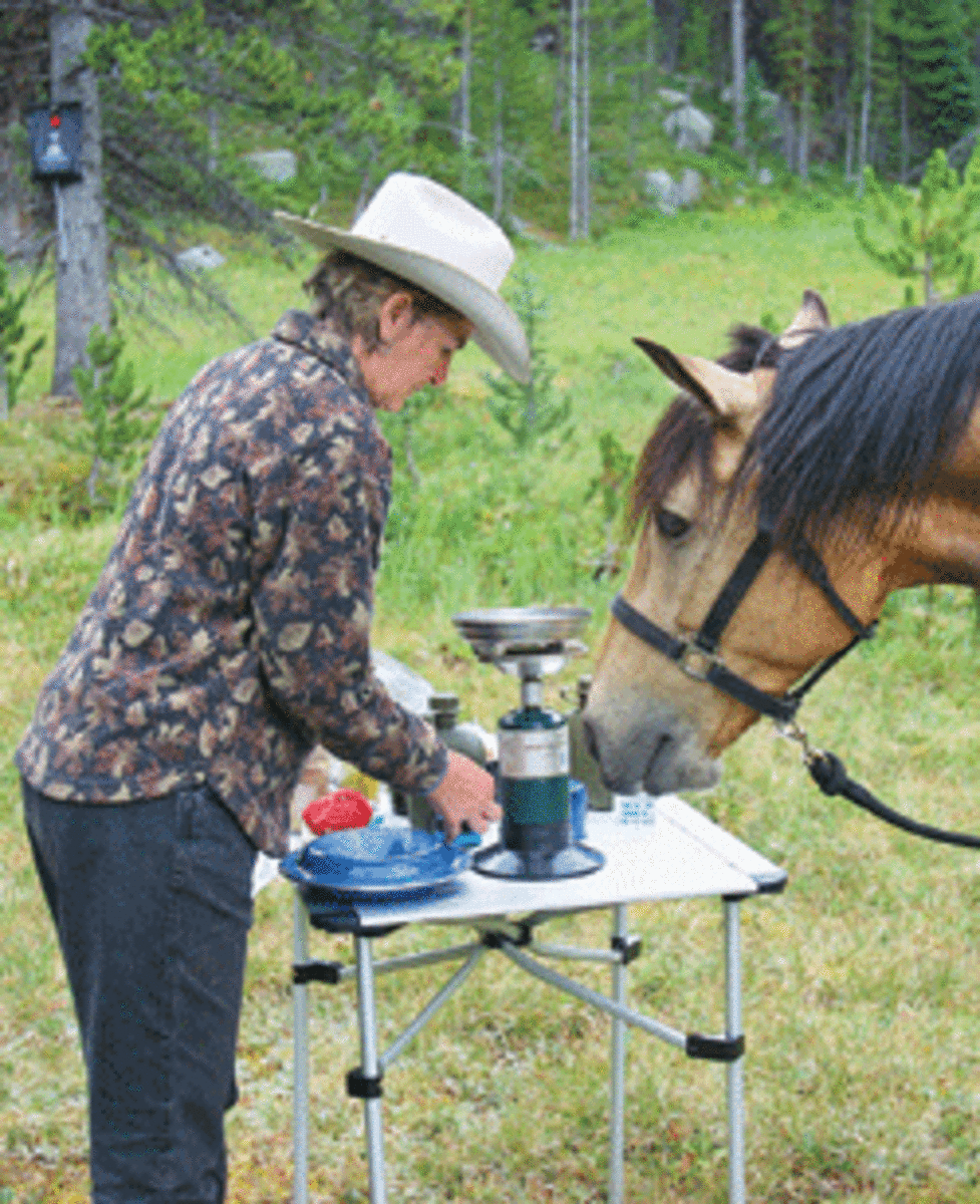
Quickly, I put the horses out to graze. Charlene gathered firewood and started coffee. As we huddled by the fire, warming our hands around steaming cups of coffee, the sun came up and seemed to kiss our skin. Leaves dripped droplets of thawing frost. All was right with our world.
On the Border
From Horseshoe Basin, we traveled west for several days following the Boundary Trail #533. This is a uniquely special trail. Its name is derived from the fact that it roughly follows the Canadian border. During its full length, it rarely drops below timberline. Prepare yourself for a journey of visual treats in every direction.
Upon leaving the tundra-like expanse of Horseshoe Basin, we could see the Boundary Trail unfolding in the distance. It made us think of novelist Louis L’Amour, who said, “The trail is the thing, not the end of the trail. Travel too fast and you miss all you are traveling for.”
After riding about 13 miles, we arrived at Scheelite Pass. We elected to ride cross country north of the trail to a meadow area to camp. There’s no trail here; several times Lily’s pack became stuck between two trees. Being a real trouper, she’d back up and go around another way!
Although not an especially scenic camp, the meadows below Scheelite Pass offer plenty of grazing, water, and shelter. An alternative location is 2.5 miles past this area to the large meadows on the left of the trail just past the Tungsten Mine.
Our layover day at Scheelite Meadows was greeted by another below-freezing morning. Frost-covered grass appeared to be encrusted with diamonds when sunlight hit it. Near camp, a patch of mud revealed a mountain lion track. A young bull moose grazed in a nearby pond. Another day began in the wilderness.
We completed a 2.5 mile day ride to the Tungsten Mine. A number of buildings dot the remains of this old mining site that dates from 1904 to 1916. Back then, 80 men toiled to dig out tungsten ore to be used for light bulbs and to harden steel. Ore was hauled out by pack trains.
This is a fascinating spot to spend time exploring old buildings and mining ruins. Members of Washington backcountry horseman groups have repaired and maintained some of the buildings.
High-Country Delight
That night, our little tent was pelted by rain and sheets of cold, icy wind. We snuggled in the tent listening to tree branches battering and scratching each other. The horses put their rears to the storm and wished they were back in their warm barn.
By morning, the storm had dismissed itself and was gone. Sunlight crept across the verdant hills like a stage curtain slowly opening. We took our cue, packed up, and began riding to our next camp at Remmel Lake.
Buddy, Scout, and Lily took off with a charge as though to leave the bothersome “storm camp” behind. We continued west on the Boundary Trail past the Tungsten Mine over to Apex Pass. From this pass to Remmel Lake is a stretch of high-country delight. Rarely is so much sustained beauty found in one section.
The scenery is an artist’s dream. Dead towering tree snags stand silently. Monstrous gray boulders are hunched down amid tamaracks and lodgepole pines. Ahead are jagged mountain peaks marching against a clear blue sky.
The pyramid-shaped peak we spotted in the distance was Cathedral Peak; at 8,601 feet elevation, it’s the highest peak along Boundary Trail. The saddle to the left of the peak was Cathedral Pass, where our horses would soon take us.
As we arrived at the boulder-strewn Cathedral Pass, we were presented with yet another scene of panoramic beauty. In the distance lie the mountains of the Cascade Range. In the foreground is Upper Cathedral Lake. On the left is a castle fortress, Amphitheater Mountain.
We descended the pass and rode by Upper Cathedral Lake. Glancing up at the rock wall above the lake, we watched mountain goats dancing across the rocks. After passing the toe of the rock mountain beyond the lake, we climbed to open tundra and could see Remmel Mountain. Our destination was in the valley below that.
After dropping elevation toward Remmel Lake, we found an unmarked trail to the left that comes out above the north side of the lake. If you miss this intersection, you’ll soon arrive at the main trail going left, which comes out at the western corner of the lake. Most camping and grazing sites are on the north side of the lake.
Into the Wild
Remmel Lake is a jewel in the wilderness! We spent three nights there, so we could have two whole days to absorb the spectacular surroundings and do a day ride. Our camp wasn’t far from the lakeshore. Pine-tree branches framed a kitchen-window view to the lake. Our horses munched the short grass with relish.
We spent one whole day relaxing, reading, and watching the horses graze. The lake is full of pan-sized cutthroat trout, so fishing was also on the agenda. We use telescoping fishing rods to save space. Hooking a high-country trout is a great experience. The trout would take our lure, then dance and slap across the water. We kept two for dinner.
We spent our other day at Remmel Lake on a day ride to Spanish Camp. This is a very pretty ride going west from the lake on Trail #510. After the intersection of Trail #504, go right on Trail #533, and you’ll arrive at Spanish Camp, which consists of a United States Forest Service cabin. USFS employees occasionally stay here when they work on trails in the area. You can keep riding through scenic country by continuing west on Trail #533.
During our last night at Remmel Lake, we were treated to a gift from Mother Nature. A sunset stretching from the eastern to the western horizons unfolded before us. Hues of scarlet, orange, and gold blossomed across the sky as the sun slowly sank below the horizon.
On the last day of our pack trip, we rode from Remmel Lake back to our starting point, thus completing a perfect loop. Follow Trail #510 going east from the south side of the lake. The route goes downhill for a number of miles until the junction of Trail #510A.
Take Trail #510A to the left; it’ll gain 1,400 feet elevation in the next 2.5 miles. The trail then emerges out to a gravel road. Follow the road left for about three miles, and you’ll arrive back at the starting point. Total ride time from Remmel Lake to the starting point was roughly six hours.
‘The Geography of Hope’
We feel very fortunate that we live in a country that values designated wilderness. We can always make more roads, but, we can’t make more wilderness. It’s finite.
As Wallace Stegner once wrote, “We simply need that wild country available to us, even if we never do more than drive to its edge and look in. For it can be a means of reassuring ourselves of our sanity as creatures, a part of the geography of hope.”