
Theodore Roosevelt National Park has all the elements needed for a true-blue Western riding adventure. The scenery is breathtaking, as well as lonesome and foreboding. One can ride trails or cross-country and most likely encounter bison herds, deer, elk, prairie dogs, bighorn sheep, and a multitude of bird life. This has been one of our favorite riding destinations, and we would like to share it with you.
The Background
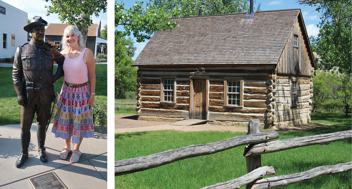
Theodore Roosevelt spent some years in North Dakota’s Badlands following the deaths of his wife and mother, both of whom died on the same day. He came here in 1883 to hunt, ranch, and have a “mental escape” from his personal problems. It worked. He fell in love with this singular landscape, calling it the “romance of my life.” He said that if it were not for his experiences in the Badlands, he could never have become president.
The Badlands is a unique geological phenomenon. The horizontal layers that can be seen in the park are made up of sediments that were deposited between 55 and 60 million years ago in lakes, ponds, and swamps. The petrified trees we see today are from the sequoia and bald cypress trees that once grew in the swampy regions. Over time, decomposing plant life became coal beds, sediments turned into sandstone, and volcanic ash became bentonite clay.
[RELATED: WHERE-TO-RIDE GUIDE]
3 Units
Theodore Roosevelt National Park (TRNP) has three separate units: the north unit, located 52 miles north of Interstate 94 on US Highway 85; the south unit, located along Interstate 94; and the Elkhorn Ranch site, located approximately midway between the two along the Little Missouri River. These three sites comprise 110 square miles of visually stunning Badlands.
The south unit has the visitor center and contains information on the history and geology of this region. All of our riding was done here in the south unit. Maps are available at the visitor center to help plan your riding. Inquire about trail conditions and trail closures. Camping information can be found here as well. There’s an entrance fee to enter the park, and certified weed-free hay is required.
An adventure, by definition, is hazardous. So before heading into the hills, take time to think and plan for you and your equine partners. Take plenty of water, food, sunscreen, a map, a multipurpose tool, and a cellphone—which may or may not work. Have an extra jacket in case you need it.
Eye of the Needle Ride
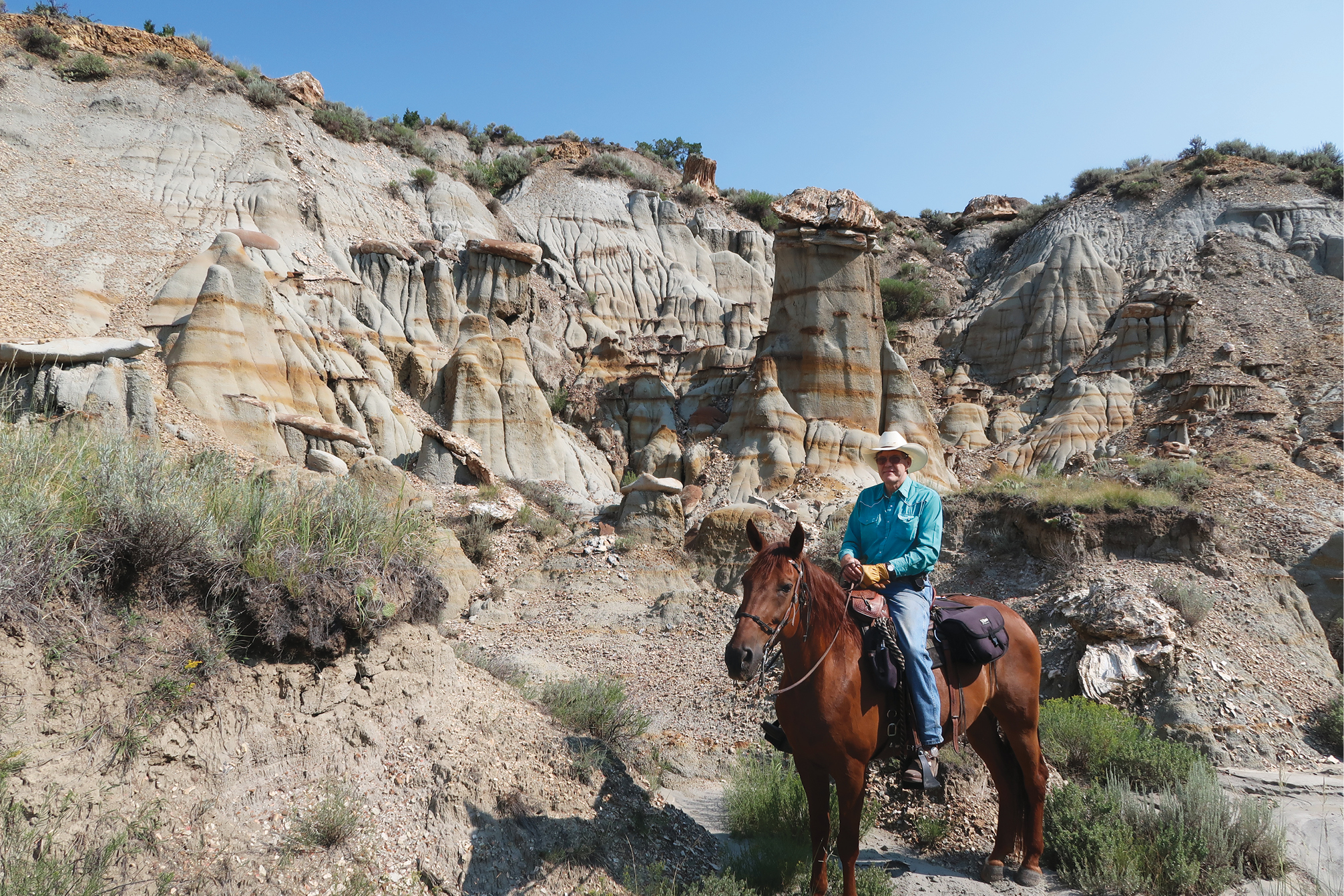
One of our favorite rides in TRNP is one we refer to as the “Eye of the Needle” because of an unusual rock formation that one can ride under. On this ride, Charlene was riding her 6-year-old Spotted Saddle Horse, Jake, and Kent was mounted on his trusty Missouri Fox Trotter, Cowboy.
We began this approximately 12-mile loop at the Jones Creek Trailhead, which is about 1 mile north of Peaceful Valley horse concession in the south unit. We rode back to Peaceful Valley on a connecting trail, then turned east and followed the Lower Paddock Creek Trail.
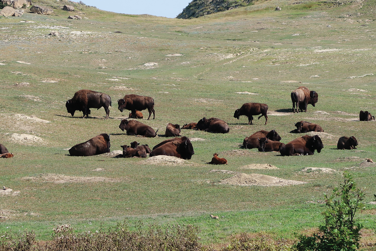
Shortly after starting the Lower Paddock Trail, we began hearing guttural grunts and groans. As we rounded a bend, we saw before us clumps of very large bison, butting heads and seemingly threatening one another in growling utterances. Bison mating season, also known as rutting, begins around July and continues into September. Quickly, we angled our horses through wide spaces in the herd keeping as far as possible from each bison. This part of the ride was definitely an “adventure!”
[MORE: TRAIL RIDING]
Rock Formation
Several miles later, on our left, we came to a rock formation that we refer to as the Eye of the Needle. This unusual formation isn’t readily seen from the trail, but is more easily seen after you pass by it. Keep looking to your left. The “eye” is about a quarter mile from the main trail and is a small rock arch large enough to ride a horse through. It’s well worth the time to photograph members of your party riding through the “eye.”
About 4.4 miles from Peaceful Valley, the Lower Paddock Creek Trail connects with a park road. Turn left and follow the road for roughly half a mile. When the road turns right, look to the valley on your left. Work your way up this valley and find a trail with trail markers. Within a mile or so, that trail will connect with the Lower Talkington Creek Trail. Turn left, and in 3.5 miles you’ll arrive back where you started.
On the ride back, keep an eye open for petrified tree stumps and piles of petrified rock that look like freshly chopped wood.
Painted Canyon Ride
Portions of this ride were cross-country, but that’s part of the thrill of riding here. You may ride trails only, cross-country for part of the ride, or figure out an entire ride on your own.
For this ride we trailered to the Painted Canyon portion of the park located a few miles east of Medora on I-94. Painted Canyon has a visitor center and beautiful views of a small, but colorful, version of the Grand Canyon. Because we were here in mid-September, cottonwoods were turning a brilliant gold and slashes of scarlet foliage added to the profusion of color.
We rode our horses across the parking lot and a short distance east to where the trail drops over the edge and descends into the canyon. The trail gently winds past pockets of timber and eroded buttes, finally reaching the canyon floor.
Kent and Charlene Krone
Relics of the Past
In the canyon, we could see remains of past eras. Twisted, mangled fingers of rock protruded from the earth. Each fingertip held what looked like a saucer but turned out to be a petrified tree stump.
We halted our horses and studied these strange apparitions. The petrified tree stumps had protected the softer rock beneath them. Erosion had removed all other soil, leaving a mysterious land of hoodoos.
When we got to the junction of the Upper Paddock Creek Trail, we turned left and went cross-country in a northeasterly direction for approximately five miles before intersecting the Upper Talkington Trail. Don’t do this unless you’re comfortable going cross-country and have a GPS, a map, or a good sense of direction. It can be confusing. Kent purchased the National Geographic Trails Illustrated Map for the park at the visitor center. This helpful map lists selected waypoints of various trails and trail junctions.
Prairie Dogs
There are five species of prairie dogs in North America but only the black-tailed prairie dog lives in in TRNP. The 1- to 3-pound rodents are referred to as “dogs” because of the bark-like sound they use in communicating with one another.
These small, short-tailed animals have eyes and ears set back on their heads so they can spot potential predators quickly. They live in closely spaced burrows with an elaborate labyrinth of underground tunnels. Several hundred inhabitants may live together in the same area, and as you ride by, you’ll see the little critters standing at the entrance to their burrow, ready to bark an alert should it be needed.
As horseback riders, we find their holes in the ground to be annoying and potentially dangerous. However, the prairie dogs provide two valuable services to the wildlife community. First of all, prairie dog towns modify the surrounding forage so that it attracts bison and pronghorns. These little creatures vary their diet of grasses and flowering plants in such a way that the surrounding forage becomes more nutritional for the large herbivores. Secondly, the prairie dogs only live 5 to 7 years. During their short life span many of them, unwittingly, provide food for badgers, coyotes, fox, bobcats, and different birds of prey.
The TRNP is one of the few areas in the West today where free-roaming wild horses may be readily observed. Horses were established in North America by 16th century Spanish explorers, and escaped horses became known as “mustangs” from the Spanish word “mesteno,” which means “wild.” They’re also referred to as feral horses, since they originally came from domesticated stock. During the time period of 1600-1850, mustangs ranged throughout the Plains in vast herds numbering in the thousands. Today, there are roughly 70 to 140 mustangs in the park.
Should you be fortunate enough to encounter wild horses while riding in the park, take time to study their behavior. Generally, they’re in bands of five to 15 animals, consisting of a dominant stallion, his mares, and their offspring. Frequently a subdominant stallion will “run second” to the leader. Stallions guard their mares by extending their heads and necks low to the ground in a threatening gesture known as “snaking.” When a band is in flight, a dominant mare will take the lead, and the stallion will guard the rear of the herd. Watching a band of horses run wild and free is exhilarating!
Maah Daah Hey Trail
This is a 96-mile multi-use trail which stretches throughout the Badlands. It’s open to bicycles, hikers, and horseback riders. Administered by the U.S. Forest Service, it became a reality in 1998 after nearly three decades of vision and planning. This trail traverses the rustic, rugged Badlands and is considered a premier backpacking trail, an epic mountain biking trail, and unforgettable horseback adventure.
The name “Maah Daah Hey” comes from the Native American language of the Mandan Hidatsa Indians. It means “grandfather, long-lasting” and is used to describe an area that has been or will be around for a long time and is deserving of respect.
Mileage for this 96-mile-long trail is marked on trail posts that are branded with a turtle shell, the Lakota Sioux Indian symbol for patience, determination, and steadfastness; characteristics that bicyclists, hikers, and horseback riders will need in order to complete the entire trail. Mile 0 is located at the southern end of the trail, 1.5 miles south of the quaint town of Medora at Sully Creek State Park. Milepost 96 is at the U.S. Forest Service CCC Camp near the north unit of the TRNP.
Lone Tree Loop Trail
This 10-mile loop ride was our last ride here. We began this ride behind Peaceful Valley Ranch and almost immediately crossed the Little Missouri River, which was murky, but shallow.
On this ride we saw many prairie dog towns, and we enjoyed listening to them bark warnings to their family and friends as we rode by. Also, we encountered bison, lots of bison. This time, we ended up doing a 45-minute detour around them because the bison were too close together to pass through. Even though bison may seem lethargic and tame, don’t underestimate them, particularly if they have calves. Horses have been gored by them.
There are some creek crossings on this loop. For safety’s sake, try to cross where others have obviously crossed. There’s quicksand in this park, but you won’t have a problem with it as long as you cross where others have been. This loop may also be extended by taking the Petrified Forest Loop Trail and returning via the Maah Daah Hey Trail.
Camping Out
If you’re coming here with friends or family, you may want to reserve Roundup Horse Camp. Reserve this through Theodore Roosevelt National Park. (See page 71 for resources and attractions.)
Roundup Horse Camp is an extremely nice camp in a beautiful setting. It has four spacious corrals, a loop drive, several picnic tables, and a large, covered kitchen area. Charlene commented on how heavy-duty the metal was in the horse corrals, and Kent countered with, “It’s not to keep the horses in. It’s to keep the bison out!”
From Roundup Horse Camp, you may ride northwest to the Little Missouri River, or south and west across the Little Missouri River to the Maah Daah Hey Trail and the Petrified Forest Loop Trail. You may also ride east, back, and across Road 702 to the Roundup Camp Trail that eventually intersects the Jones Creek Trail. Enjoy plentiful riding and sunsets from this well-positioned camp.
[MORE: WHAT KIND OF TRAIL RIDER ARE YOU?]
End of the Trail
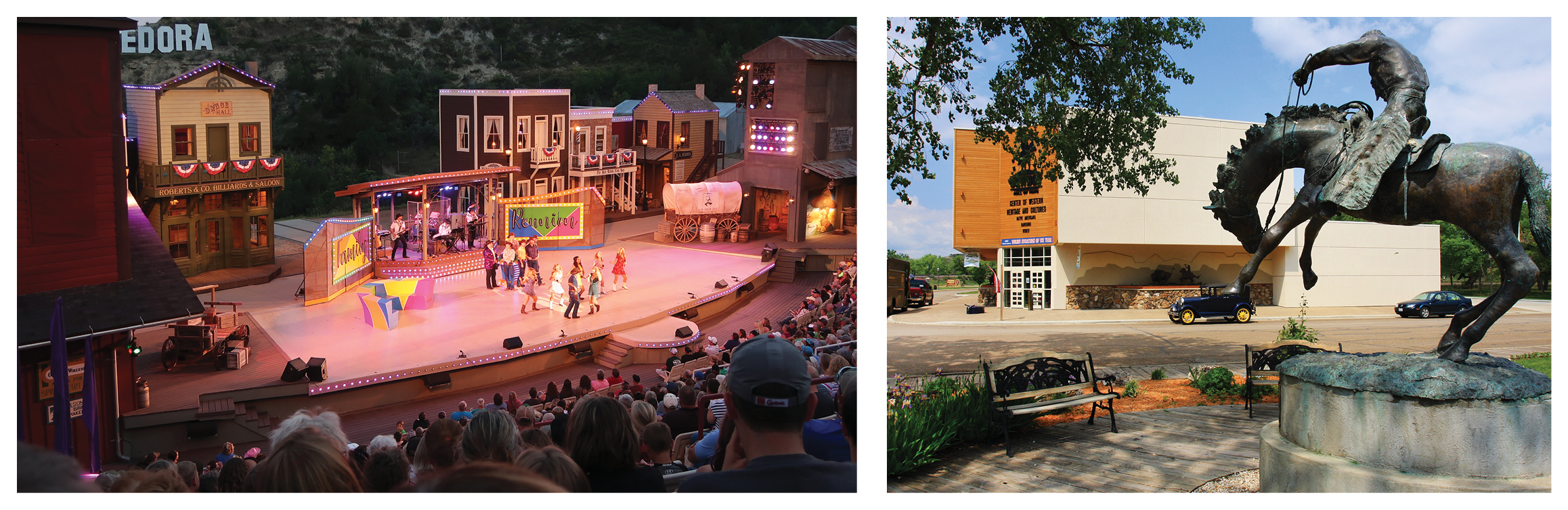
No doubt about it! This is a great place to have a riding adventure! You can ride here for years yet discover something new every time you come. In addition to riding, we would suggest a visit or two to Medora where there’s much to be learned about this area and a great deal to be enjoyed.
eodore Roosevelt’s personal possessions, and Roosevelt’s Maltese Cross Cabin. Roosevelt lived, worked, and wrote in this cabin during his time in the Badlands. (701) 623-4466, nps.gov/thro.